
Start: tentsite at mile 764
End: tentsite at mile 771
Miles covered: 7 on the PCT and 17 to Mount Whitney and back. Most of the 17 miles were with a day pack only, but I had to count them. It is Mount Whitney after all.
PCT mile marker: 771/2652
Highlight: The summit, of course!
Biggest challenge: Getting enough miles in to be able to get over Forester Pass at a decent hour the next day.
Interesting rock formations near the summit:

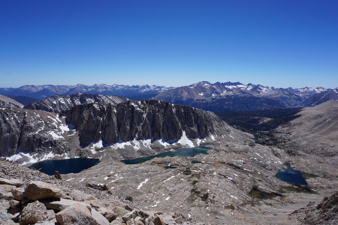
The three lakes I could see most of the way up and down Mount Whitney. The one on the far right is appropriately named Guitar Lake:

Hello from the East Coast. Standing on top of the lower 48. It is a nice view from up there and cold! Beautiful day. Keep it up!
Hello from the East Coast. How’s it feel to be standing on top of the lower 48? Looks like beautiful day. It is a nice view from up there and cold! Keep it up!
It’s a strange feeling to be looking down on everything around. The PCT is incredible.