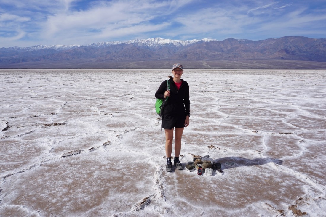
By winter wonderland, I don’t mean covered in snow, although Death Valley does get some snow at the higher elevations. I mean that it’s a great place to go in the winter. For starters, the lowest point in North America, Badwater Basin, gets very hot during all other times of the year. Even in February, the hike out to the specific spot that is the lowest point (four miles from the parking area) was quite warm. Any other time of year, it would be downright brutal. Most people there only walked out a half mile to the solid white salt flats, but we (ShamWow and I) thought it would be fun to trek all the way out to the lowest point. If you want to do the same, just plug the location (36.24192, -116.82558) into your favorite mapping device, and head that way. Otherwise, it would be difficult to find, as it is only marked with a small pile of rocks.
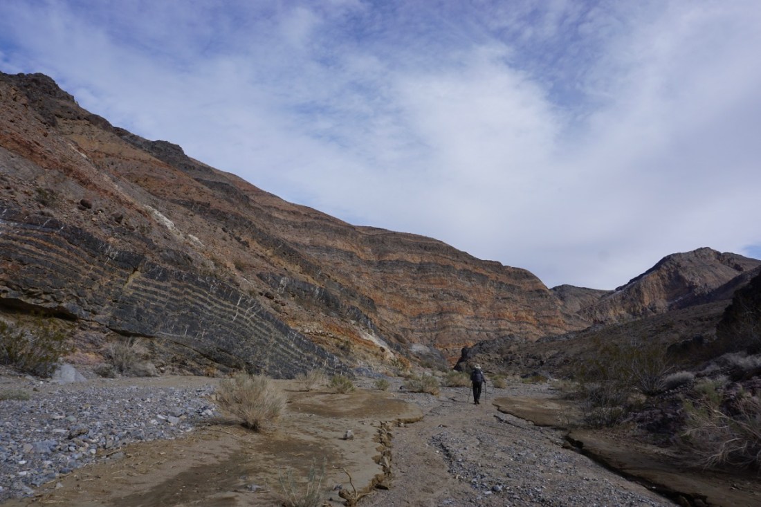
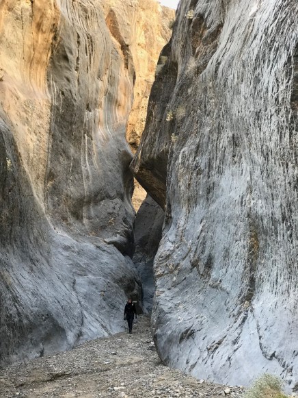
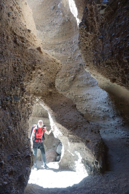
If you’re looking for a longer trip, the Cottonwood/Marble Canyon Loop is probably the best in the park. If you can drive all the way to the top of the loop, it is 26 miles of beautiful terrain, including some towering, photogenic slot canyons. If you don’t have a really good off-road vehicle, plan for an extra 3 miles round trip from the closest reasonable place to park. Even then, there’s a 10-mile drive from Stovepipe Wells over terrain that is rough on any vehicle.
If you take the loop clockwise, there are very good camping spots at 8.5, 12 (most reliable water), 17, and 24 miles. (See the NPS map for details.) It can easily drop below freezing at the higher elevations in winter–you’ll reach 5000 ft on this hike–so plan accordingly. It was unseasonably cold for our first few nights in the park, and it dipped to 20 deg F one of the nights. My hike was inspired by DC UL Backpacking, so please check out their trip report for more details. Here are some of my favorite photos from the loop:
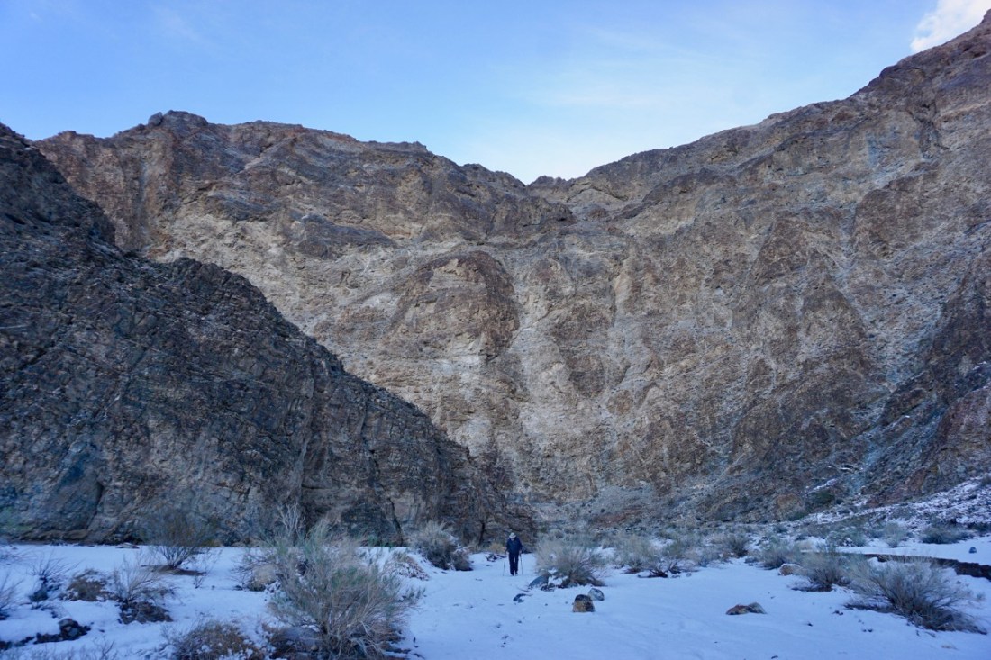
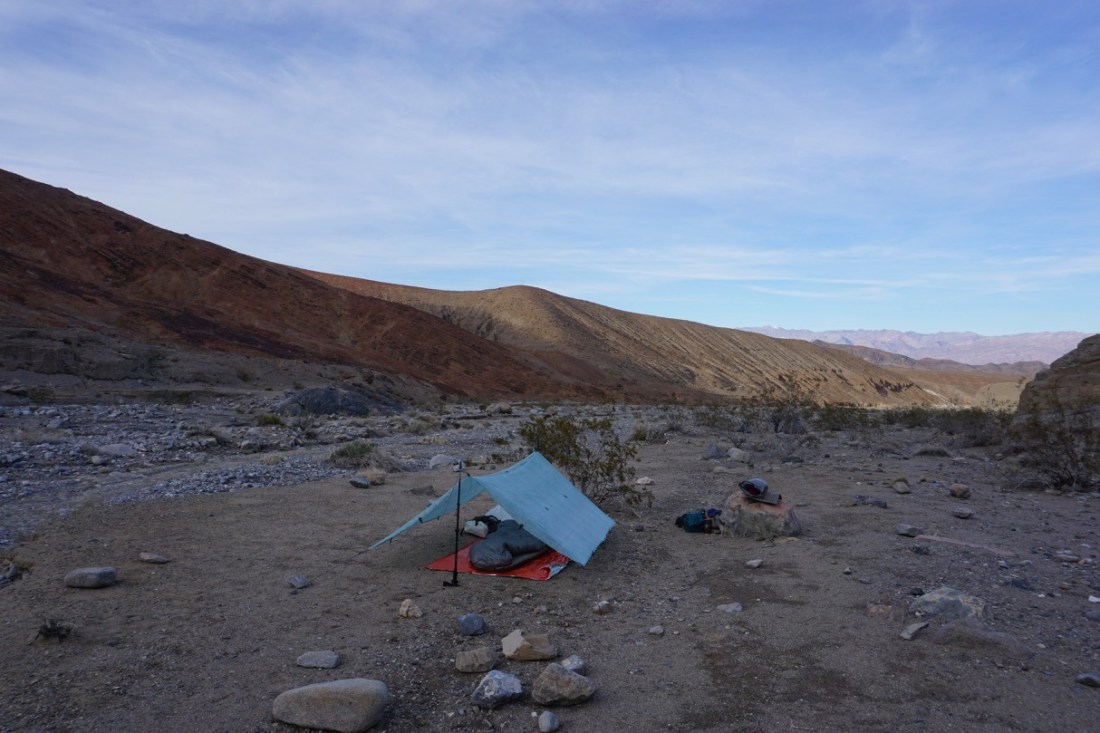
There were two difficult sections for us. The first was the steep descent into Deadhorse Canyon. If you use the GPX file available on the Death Valley National Park website, recognize that there is an alternate route around one more hill that leads to a more gradual descent down to the campsite. The other difficult part was the 8-foot dryfall just past the campsite. We knew it was coming up, so we decided to tackle it first thing in the morning when our legs were fresh. When we arrived at the dryfall, we contemplated it for a while, and then looked for another way around. If I had jumped down, I would have landed in a 6-inch puddle of very cold water. I also would not have trusted myself to help ShamWow down after me. It took some backtracking and some crab-walking up a steepish slope, but we found a reasonable way around to avoid the dryfall.
Water was not an issue for this trip. We carried quite a bit more than we needed, because we didn’t want to rely on inconsistent water sources and the rangers at Furnace Creek didn’t have up-to-date information. We only tanked up at Cottonwood Spring (mile 12), even though it was available at two other places, probably because of the snow melt. Speaking of snow melt, we didn’t realize until much later how lucky we were to have made it to the top of the Cottonwood/Marble Canyon loop by car. We found out from another backpacker that they closed the 10-mile stretch of road (and many others in the park) a few hours after we drove in because cars were getting stuck in the mud.
After completing the Cottonwood/Marble Canyon loop, we headed to Sidewinder Canyon, just south of Badwater Basin. Although it is not really long enough to be an overnight trip, we turned it into one. The original plan was to go up Sidewinder and into all of the side slot canyons, then back down to the car and up the other side, which is Willow Canyon. At most, the Sidewinder portion would be about 6 miles round trip. The slot canyons weren’t as majestic as Marble Canyon, but they were interesting, and some of them were as long as a mile. Reaching the “end” of any side slot required scrambling on hands and knees through tight spaces or climbing over 5-foot falls. The natural bridges were a fun part of the side canyons.
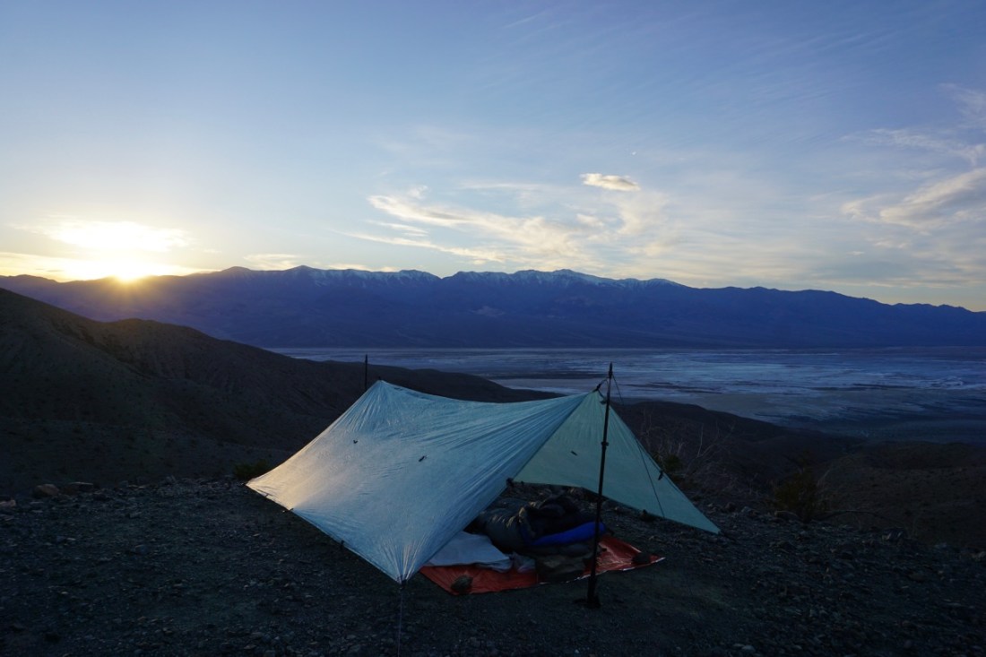
The pleasant surprise at the top of Sidewinder Canyon was a steep scramble up to a ridge from which you could see back down to Badwater Basin. The views were incredible, and there were some small saddles just large enough for a tent, so we decided to stay. (Somehow I knew there was a reason we carried our full packs all day.) It was a glorious afternoon and a very, VERY windy night. I ended up taking my tarp down around 10pm and cowboy camping for the rest of the night.
Because we wanted to stay flexible, we didn’t make reservations at the Furnace Creek campground. Instead, when not in the backcountry, we stayed at the Texas Spring campground, which is first-come, first-served. The tent sites were decent, and the restrooms were nice, but I much preferred the beauty and solitude of the backcountry campsites, wind and all.
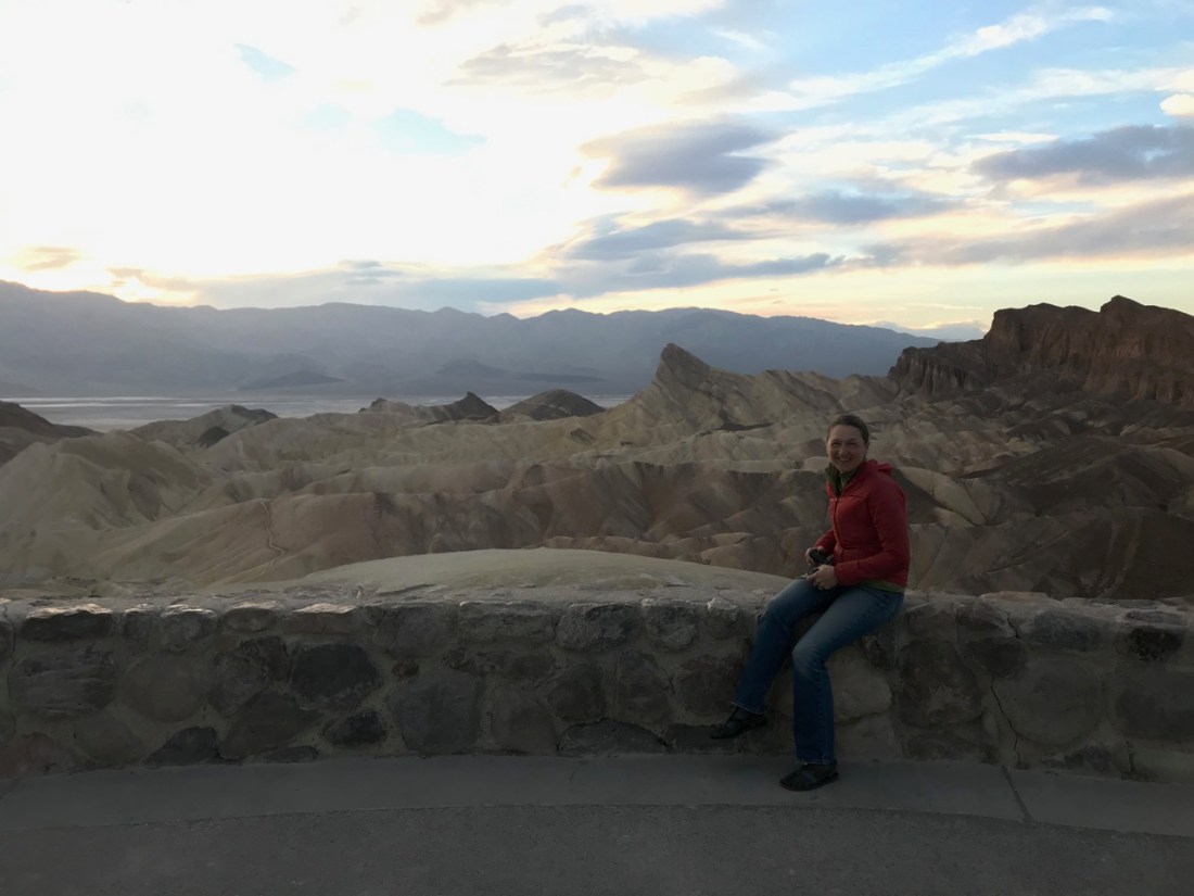
For the last evening in Death Valley, we drove to Zabriskie Point. It was too cloudy for a brilliant sunset, but the ribbons of color in the rocks made it worth the visit.

Love the post! Gorgeous photos. Hope all is well. Hugs-
Sent from Yahoo Mail for iPhone